Wetland professionals at a Vermont Association for Wetland Science (VAWS) workshop discuss whether a soil pit is in wetland or upland.
Vermont Business Magazine Despite the devastating rains of 2023 and 2024, the Green Mountain State has been in a dry cycle through much of the first half of the 2020s. These dry conditions make it hard to find the edges of the state’s wetlands, the places where land and water meet.
To compound the issue, the entire state of Vermont has experienced at least a moderate drought intensity. Over a third of the state, in the central and Connecticut River Valley zones, has now moved up to severe drought status.
The Department of Environmental Conservation (DEC) reminds wetland professionals, property owners, farmers, realtors, non-profits, and towns to accurately identify wetlands, even in a drought.
“The accurate delineation is key to avoiding undue adverse impacts to wetlands,” said DEC Commissioner Misty Sinsigalli. “We rely on wetlands to improve water quality, create habitats for diverse wildlife, and reduce flood impacts while protecting communities.”
Spanning over 300,000 acres, Vermont’s wetlands range from marshes to swamps. Water can flood (or saturate) wetlands year-round or for a few weeks of the year. As we move into the drier months, it’s a good time to ask: what happens with wetlands when the rain does not fall?
Longer periods of drought can cause wetland boundaries to change. These changes happen as plant communities respond to lack of water and upland plants (those that do not like wet feet) are able to move into areas that used to be too wet for them. Wetland professionals then need to look past the plant community and make sense of cues from the soil and landscape. In some cases, like in historically farmed or heavily managed wetlands, professionals may need to wait for more normal conditions to assess a wetland.
“One of the many benefits wetlands provide is buffering us from drought by holding water from rainfall like a sponge and recharging groundwater,” said DEC Wetland Ecologist Elijah Schumacher. “Healthy, resilient wetlands can help reduce the effects of not only drought but also flooding and climate change.”
In 1990, the State passed the Vermont Wetland Rules to better protect wetlands and their irreplaceable functions and values. The DEC Wetlands Program implements these rules through education, project review, and enforcement.
Activities within protected wetlands and their 50-foot buffers often require a permit. Use the Wetland Screening Tool to find out about wetlands on a property. Remember, not all wetlands are mapped, and not all wetland areas will show up on the Wetland Screening Tool. To learn more, contact a State Wetlands Ecologist.
The Department of Environmental Conservation is responsible for protecting Vermont's natural resources and safeguarding human health for the benefit of this and future generations. Visit dec.vermont.gov and follow the Department of Environmental Conservation on Facebook and Instagram.
This institution is an equal opportunity provider. To file a discrimination complaint, for questions, free language services, or requests for reasonable accommodations, please contact ANR’s Nondiscrimination Coordinator at [email protected] or visit ANR’s online Notice of Nondiscrimination. 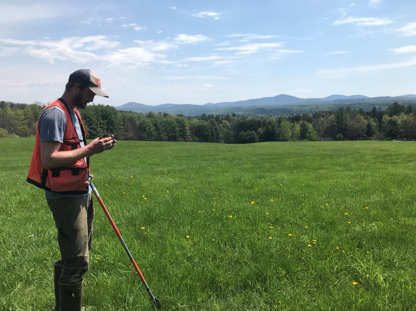
Hydric soil is one of three indicators of wetland presence. Here, DEC Wetland Ecologist, Elijah Schumacher, examines a soil core for signs of a high water table.
Vermont Agency of Natural Resources, Montpelier, VT Website.
To support vital journalism, access our archives and get unique features like our award-winning profiles, Book of Lists & Business-to-Business Directory, subscribe HERE!