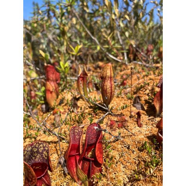
Pitcher plants flourishing in a peatland wetland in Victory, Vermont.
Vermont Business Magazine The Vermont Department of Environmental Conservation (DEC) invites the public to comment on draft updates to the state wetland maps in 150 towns, covering over 45% of Vermont. The updated maps show the approximate location and shape of wetlands across major parts of Caledonia, Windham, Windsor, Grand Isle, and Essex counties.
Combined with other recent map updates, approximately 80% of Vermont’s wetland maps will soon be current, leaving only 20% outdated. The updates are required by the Flood Safety Act, Act 121, passed in 2024 and are ahead of the timeline established by law. DEC anticipates placing the remaining areas of Vermont on notice this year.
Using new technology and high-quality aerial images, DEC will continue to update maps for the entire state to better identify wetlands, which in turn supports project developers’ efforts to plan projects in ways that avoid and minimize impacts to wetlands.
“Wetlands are transitional areas where land and water meet,” said DEC Commissioner Misty Sinsigalli. “Marshes, swamps, and other types of wetlands offer vital benefits to Vermonters, from drought prevention and floodwater storage to quality of life.”
Robust wetland maps can help property owners, towns, and developers by:
- Guiding development
- Streamlining the wetland regulatory process
- Informing real estate decisions
- Supporting land use planning
- Assisting wetland restoration and mitigation efforts
“Wetland maps are important planning tools, but up until last year much of the state was last mapped over 30 years ago and missed a significant amount of wetland area,” said Laura Lapierre, DEC Wetlands Program Manager. “Our department encourages everyone to check out the online interactive wetland map update.”
View the changes to the Vermont Significant Wetlands Inventory Map on the online interactive map. To learn more, check out the Environmental Notice Bulletin materials or attend one of the public meetings this month:
March 18, 2026, 1:00 pm:
- In-person: Shelburne Town Hall, Meeting Room 2, 5420 Shelburne Rd., Shelburne, VT
- Virtual access: Register in advance for this meeting.
March 23, 2026, 5:30 pm:
- In-person: Hartford Town Hall, Meeting Room 2, 171 Bridge Street, White River Junction, VT
- Virtual access: Register in advance for this meeting.
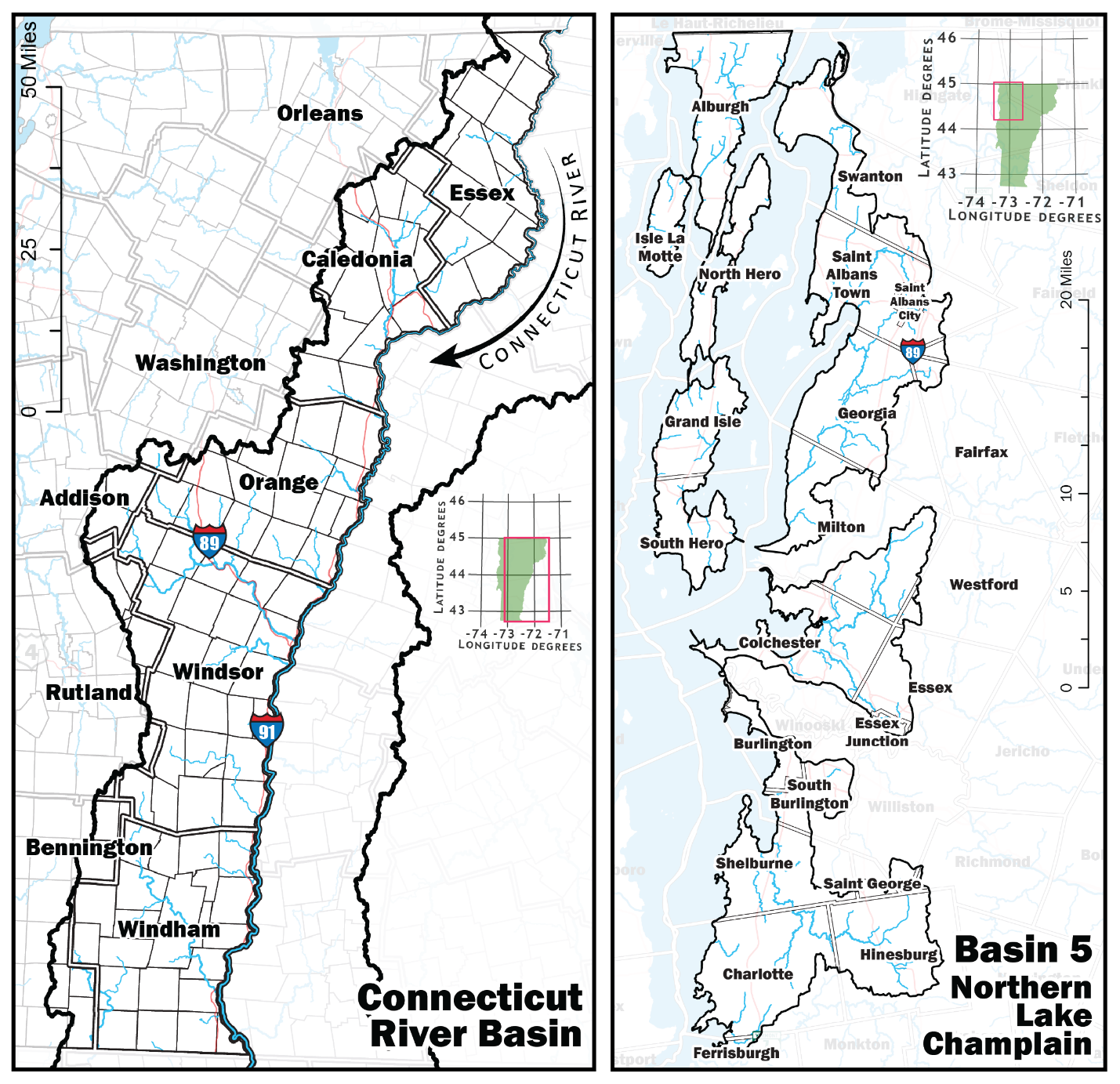
Areas of map updates include the Connecticut River Basin (eastern portion of the state) and the Northern Lake Champlain Basin (northwestern portion of the state). Connecticut River Basin towns include those of Addison County (Goshen, Granville, Hancock, Ripton), Bennington County (Glastenbury, Landgrove, Peru, Readsboro, Searsburg, Stamford, Sunderland, Winhall, Woodford), Caledonia County (Barnet, Burke, Danville, Groton, Kirby, Lyndon, Newark, Peacham, Ryegate, Saint Johnsbury, Sheffield, Stannard, Sutton, Walden, Waterford, Wheelock), Essex County (Averill, Avery's Gore, Bloomfield, Brighton, Brunswick, Canaan, Concord, East Haven, Ferdinand, Granby, Guildhall, Lemington, Lewis, Lunenburg, Maidstone, Norton, Victory, Warren's Gore), Orange County (Bradford, Braintree, Brookfield, Chelsea, Corinth, Fairlee, Newbury, Orange, Randolph, Strafford, Thetford, Topsham, Tunbridge, Vershire, Washington, West Fairlee, Williamstown), Orleans County (Glover, Westmore), Rutland County (Chittenden, Killington, Mendon, Mount Holly, Mount Tabor, Pittsfield, Shrewsbury), Washington County (Cabot, Marshfield, Plainfield, Roxbury, Warren), Windham County (Athens, Brattleboro, Brookline, Dover, Dummerston, Grafton, Guilford, Halifax, Jamaica, Londonderry, Marlboro, Newfane, Putney, Rockingham, Somerset, Stratton, Townshend, Vernon, Wardsboro, Westminster, Whitingham, Wilmington, Windham), and Windsor County (Andover, Baltimore, Barnard, Bethel, Bridgewater, Cavendish, Chester, Hartford, Hartland, Ludlow, Norwich, Plymouth, Pomfret, Reading, Rochester, Royalton, Sharon, Springfield, Stockbridge, Weathersfield, West Windsor, Weston, Windsor, Woodstock).
The Department of Environmental Conservation is responsible for protecting Vermont's natural resources and safeguarding human health for the benefit of this and future generations. Visit dec.vermont.gov and follow the Department of Environmental Conservation on Facebook and Instagram.
Vermont Agency of Natural Resources Website.
To support vital journalism, access our archives and get unique features like our award-winning profiles, Book of Lists & Business-to-Business Directory, subscribe HERE!