The Lake Champlain Byway is pleased to issue its Draft Lake Champlain Byway Interpretation Coordination Plan for public comment. In particular, the byway is looking for feedback from residents, tourism-related businesses and intrinsic resource site managers from the 22 Vermont towns that comprise the byway. The draft plan and instructions for comments can be viewed at www.lakechamplainbyway.com. This is the first interpretation coordination plan for the Lake Champlain Byway. The goals of the plan are to build awareness among managers of the different sites along the byway about each other’s sites and programs; to identify areas of overlap where collaboration may be possible; and to assist with the development of consistent messaging among the sites and for the Byway itself.
 The byway includes many important businesses along its route, but this plan is focused only on the intrinsic resource sites such as parks, boat launches, trails, natural areas and museums.
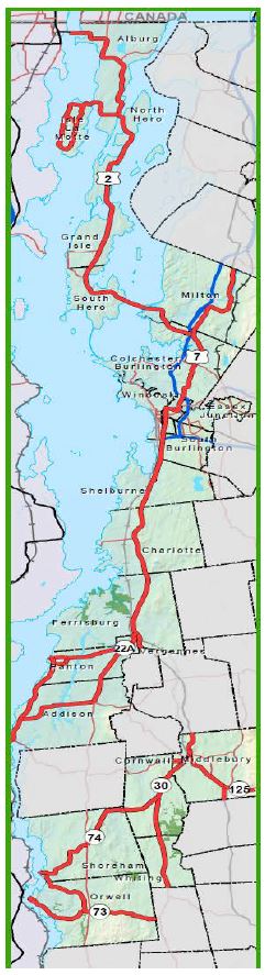
The Lake Champlain Byway is located in the northwest portion of the state. From north to south, the route is 184 miles (215 km) long and consists of U.S. Route 2 through Grand Isle County, U.S. Route 7 through Chittenden County and then south into Addison County. It is comprised of 22 communities along this route and more than 200 intrinsic resource sites managed by government entities and non-profits. These communities include Alburgh, North Hero, Isle La Motte Grand Isle, South Hero, Milton, Colchester, Essex Junction, Winooski, Burlington, South Burlington, Shelburne, Charlotte, Ferrisburgh, Vergennes, Panton, Addison, Middlebury, Cornwall, Shoreham, Orwell and Whiting. The Byway is one of Vermont’s ten designated Byways, viewable at www.vermont-byways.us
The byway is managed by the Lake Champlain Byway Council with a 12-member board consisting of representatives from the region’s three regional planning commissions, its two chambers, Lake Champlain Bikeways, the Lake Champlain Basin Program and five at-large members. The plan’s development is supported by a grant from the Federal Highway Administration’s National Scenic Byway Program.